![]() 3 Rivers Wet Weather
3 Rivers Wet Weather
Sewer Atlas Documentation and User Guides
The 3RWW Sewer Atlas represents the next generation of mapping products from 3 Rivers Wet Weather (3RWW).
General Documentation
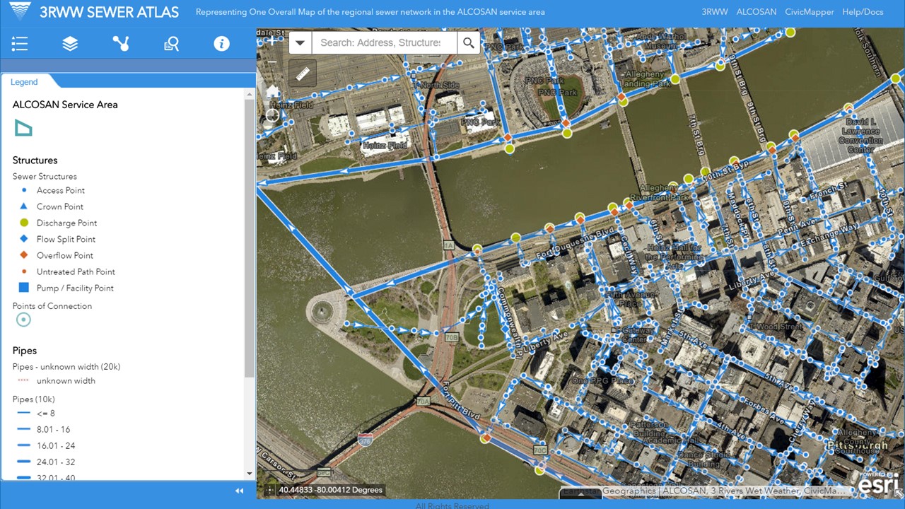
Interface →
This describes the basic layout and tools available in Sewer Atlas.
Common Tasks →
This describes the Sewer Atlas in terms of common tasks that the user might need to perform, such as turning layers on and off, printing the map, or tracing the sewer network. Start here if you’re already comfortable with using web GIS.
Demo →
For an overview of the functionality of the Sewer Atlas, with Q/A from users, watch our November 2015 Sewer Atlas webinar on Youtube.
Workflow Guides
Discharge Tracing Guide →
This user guide describes how to use the 3RWW Sewer Atlas in desktop and field workflows for identifying potential discharges into the sewer system.
Need a specific workflow documented? Let us know at 3rww@civicmapper.com
Data
Sewer Atlas Data Changelog →
An ongoing summary of general changes made to the data behind the Sewer Atlas, starting with the 2017 quarterly updates.
Data Downloads and Services →
Instructions for accessing Sewer Atlas resoures.